Tom, Oscar, and I spent 2 weeks in the Canadian Rocks, hiking in the 4 National Parks (Jasper, Banff, Yoho, and Kootenay) and in several provincial parks in the Kananaskis area (called K-Country) and even across the Continental Divide into British Columbia. This was the first time Oscar had hiked with either Tom or me. We hiked about 80 miles.
At first, the longer range weather forecast for the area looked to be warm (mid 80’sF) but as the day to leave came closer the forecast was for cooler weather. We all took shorts but we never wore them. At times it was 34F when we started a hike and I had 4+ layers to stay warm. I did not sweat very often (unless I was too lazy to remove a layer). Initially we were disappointed with the smoky conditions – the area had been experiencing poor visibility for the past 6 weeks due to smoke blowing in from the west from all the fires in British Columbia. Fortunately for us, the colder weather from the north cleared out most of the smoke a few days after we arrived.

Smoky Skies on the Sulfur Skyline trail – August 23, 2018 about 5 miles, + 2129ft elevation gain
Our first hike in Canada was in Jasper National Park on the Sulfur Skyline trail which was a steep hike up to a vista. It would have been better without all the smoke but still a nice view. Oscar is on the right looking out over the valley. IMG_82857_SulphurSkyline_Jasper

Maligne Canyon trail Jasper Nat Park , August 23, 2018 – 2.5 miles
On the way back from the Sulfur Skyline trail we stopped by Maligne Canyon, a popular area. Almost all of the Canadian Rockies were formed from limestone that was pushed up to form the Continental divide (None of the hard granite like the US Rockies). As a result, the rivers can cut deep canyons in the soft limestone. This canyon is more than 300ft deep in places. This popular walk crosses the canyon with a series of bridges providing better views down into the canyon. 82952_MaligneCanyon_Jasper

Maligne Canyon trail – Jasper Nat Park , August 23, 2018
From the 4th bridge you could see this small waterfall. IMG_82962_MaligneCanyon_Jasper

Randy, Oscar and Tom on the Valley of the Five Lakes trail Jasper Nat Park August 24, 2018 – 5.6 miles ~+215ft
On our second day in Jasper it was raining. We decided to hike the trail around the Valley of Five Lakes. We started at the 5th lake and met two guys from Israel and exchanged taking photos. Still smoky. There were several people who claimed they saw a bear up the trail and decided to not complete the loop around the lakes. We did not see any bear here or on any trail while we were in Canada (unless you count the stuffed, fake bears in some of the Banff stores). IMG_82983_ValleyofFiveLakes_Jasper

Randy and Tom in the Red Chairs on the Valley of the Five Lakes trail Jasper Nat Park August 24, 2018
We found these red chairs between the 3rd and 4th lakes and wondered what that was all about. Apparently, these chairs are on several trails in the Canadian National Parks and loved by some (as a photo op) and hated by others (eye sore). They did have a nice view. IMG_83009_ValleyofFiveLakes_Jasper

Valley of the Five Lakes trail Jasper Nat Park August 24, 2018
View of the 3rd lake with the 4th lake just beyond. You can also pick out the red dot of the red chairs in the upper left hand side. IMG_83015_Valley of FiveLakes_Jasper

Whistler Summit trail Jasper Nat Park , August 24, 2018 , 2.3 miles, +895ft elev
It stopped raining so we decided to ride the gondola up and hike the remaining way to the summit of Whistler’s Mountain. That’s Oscar at the upper right side of the photo. Still the smoky haze limited the views. IMG_83067_MtWhislers_Jasper

Tangle Creek Falls, Jasper National Park, August 25, 2018
This 114 ft waterfall is right off the road from Jasper to Banff. IMG_83104_TangleCkFalls_Jasper

Athabasca Glacier Toe – Jasper Nat Park , August 25, 2018, 1.2 miles
On our way to Banff, we stopped to hike the short distance toward the toe of the Athabasca glacier, the white formation in the left center. You could not get to the glacier due to a river, although for a pretty good fee, they would bus you out to the glacier. We did not have time to do this as we were meeting up with White Mountain Hiking tours in a hour or so. Oscar has socks on his hands – did not bring gloves. There were markers on the ground from where the glacier had retreated over the years. It was interesting that most of this hike would have been covered by the glacier 50 years ago. The rock cairn was already there but Oscar added a stone on top. IMG_83134_AthabackaGlacier_Jasper

Bridal Veil Falls Banff Nat Park, August 25, 2018
Also on our way to Banff, we stopped to hike a social trail the very short distance to Bridal Veil Falls. This water fall drops 1200ft to the river. IMG_83150_BridalVeilFalls_Banff

Bridal Veil Falls Banff Nat Park, August 25, 2018
Tom is near the top of the falls and Oscar and I are at a overhanging rock formation to get a better view. IMG_83190_BridalVeilFalls_Banff

Bridal Veil Falls Banff Nat Park, August 25, 2018
Oscar enjoying a great view of the falls, but it was a long drop down…. IMG_83195_BridalVeilFalls_Banff

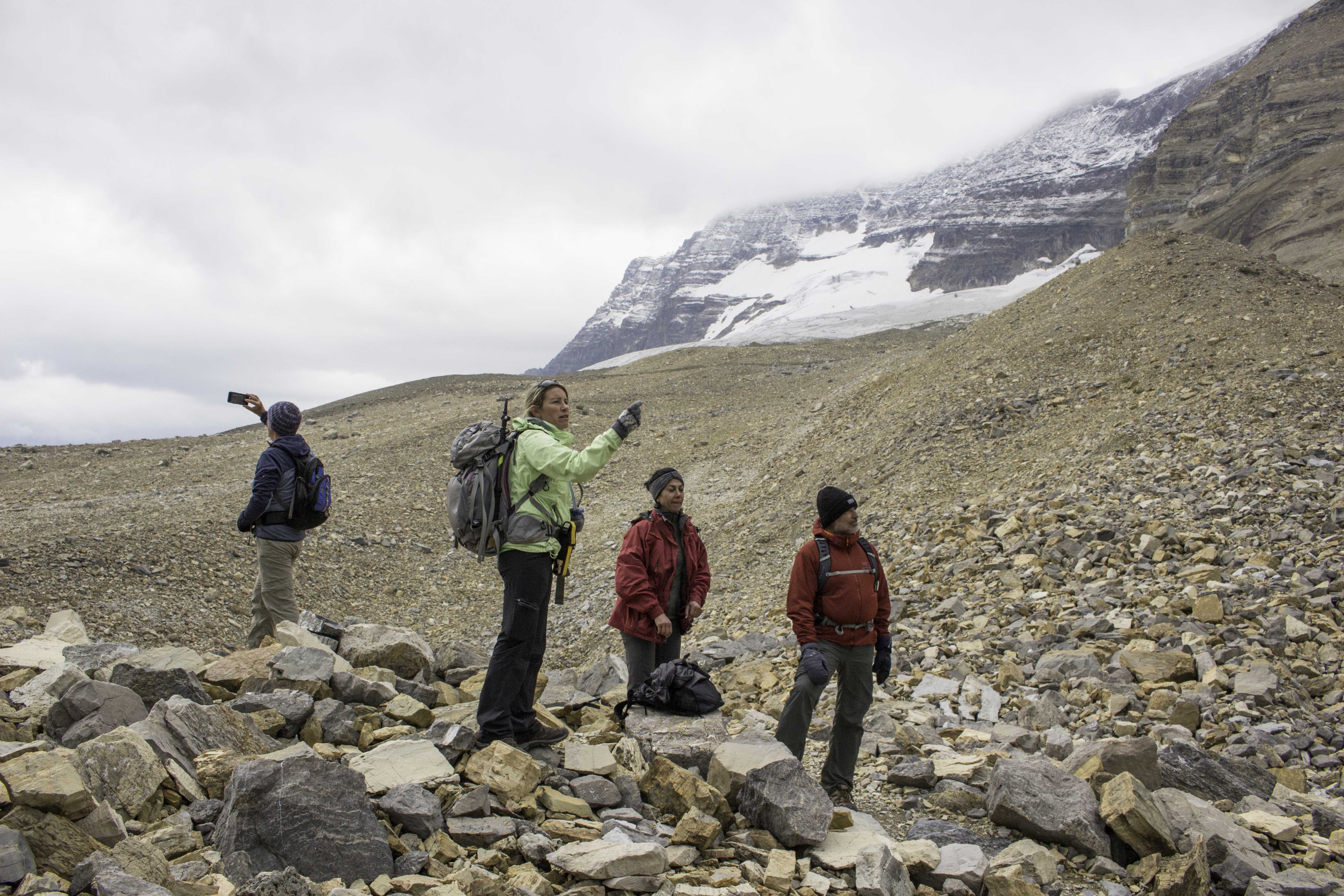
Upper Kananaskis Lake – Peter Lougheed Provincial Park, August 26, 2018 8.5 miles, +1050ft elv
We joined up with White Mountain Hiking tours for a while to explore the Rockies with a guide. Michelle, our guide is in the green jacket. Michelle is from England but now has Canadian citizenship. Monireh was the only other hiker besides us on the tour. It was a great group and we had fun. The first hike was supposed to be up to Chester Lake, but a bear attack in the area resulted in the trail being closed. Instead we hiked from Upper Kananaskis Lake to Rawson Lake. We saw a nice waterfall and some flowers (mostly Fleabane and Arnica). IMG_83205_UpperKananaskisLk_PeterLougheed_Pk

Upper Kananaskis Lake – Peter Lougheed Provincial Park, August 26, 2018
Still smoky but an interesting view. IMG_83218_UpperKananaskisLk_PeterLougheed_Pkc
Rawson Lake – Peter Lougheed Provincial Park, August 26, 2018Â
Here we are hiking part way around Rawson Lake. IMG_83284_RawsonLk_PeterLougheed_Pk

Coral Fungi – Peter Lougheed Provincial Park, August 26, 2018
Ramaria pallida is a coral mushroom in the family Gomphaceae. This one was about the size of a soccer ball. IMG_83296_CoralFungi_PeterLougheed_Pk

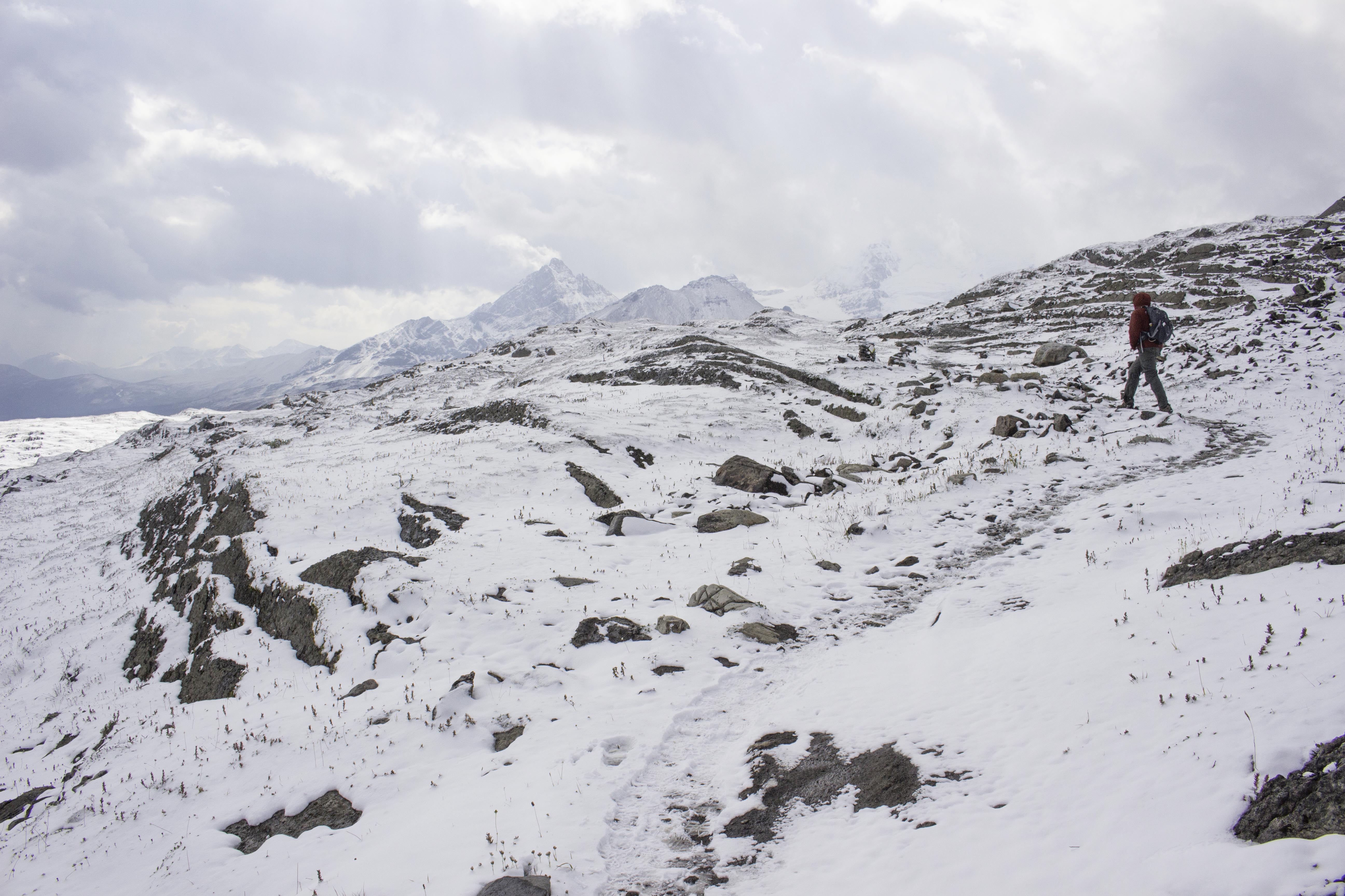
Sunshine Meadow Banff AB, August 27, 2018 ~5.4 miles, 985ft elev
Overnight it rained (and snowed at higher elevation) and the north wind finally pushed the smoke out of the Rockies. We hiked in the Sunshine ski area, both in Banff and Mt Assiniboine Provincial Park in British Columbia (crossed the Continental divide). There had been no snow here the day before and it was mostly gone before we finished the hike (but pretty while we were hiking). There were several snow ball fights. IMG_83339_Sunrise_Banff

Sunshine Meadow – Banff AB, August 27, 2018
Because the ground was so warm, none of the snow remained on the trails. All the visible snow was sitting on the grass and trees, insulated from the warm ground. IMG_83353_Sunrise_Banff

Rock Isle Lake, Sunshine Meadow – Mt Assiniboine BC, August 27, 2018 IMG_83380_RockIsleLk_Banff

Rock Isle Lake, Sunshine Meadow Mt Assiniboine BC, August 27, 2018
IMG_83390_Sunrise_Banff

Rock Isle Lake, Laryx Lake, and Grizzly Lake Mt Assiniboine BC, August 27, 2018
You could see the three lakes we were hiking around the rest of the day: from left to right, Rock Isle, Laryx, and Grizzly. The odd thing that no one could explain was that Layx and Grizzle had no snow near them but there was snow everywhere else. We had lunch at Laryx Lake and could actually see patches of blue sky. IMG_83438_Sunrise_Banff

Rock Isle Lake, Mt Assiniboine BC, August 27, 2018
Note the snow is already starting to disappear and when we returned from our hike around the other lakes, it was gone (see next photo) IMG_83451_Sunrise_Banff

Rock Isle Lake with no snow – Mt Assiniboine BC, August 27, 2018
By afternoon the snow was melted off. It was fun while it lasted. IMG_83547_RockIsleLk_Banff

Trumpet Lichen, Stanley Glacier, Kootenay Nat Park, August 27, 2018
Trumpet Lichen (Cladonia fimbriata is lichen belonging to the family Cladoniaceae) caught my eye during a hike out to Stanley Glacier. It is sometimes also called “Golf Tee” lichen. IMG_83592_Trumpet_Lichen_Stanley_Glacier

Pika near Stanley Glacier, Kootenay Nat Park, August 27, 2018
We found this small pika defending it’s turf. A pika is a small mammal with short limbs, very round body, rounded ears, and no external tail and is a close cousin of the rabbit. This one looked to be about 4-5 inches long. They make a loud chirp and this one was not happy that we were crossing its territory. In our travels we also saw marmots, elk, big horn sheep, ground squirrels but did not see a moose or bear. IMG_83602_Pica_StanleyGlacier_Kootenay

The Beautiful Lake Moraine, Banff, August 29, 2018
On our way to hike in the Lake Louise area we had to stop and see the beautiful Lake Moraine. This photo is taken from the rock pile at the end of the lake. IMG_83673_LakeMoraine_Banff

Lake Louise from the Fairmont, Banff, August 29, 2018
The Fairmont Chateau Lake Louise hotel grounds is where we started the Plain of the Six Glaciers hike. IMG_83725_LakeLouise_Banff

Fairmont from Lake Louise, Banff, August 29, 2018
IMG_83741_Fairmont-LakeLouise_Banff

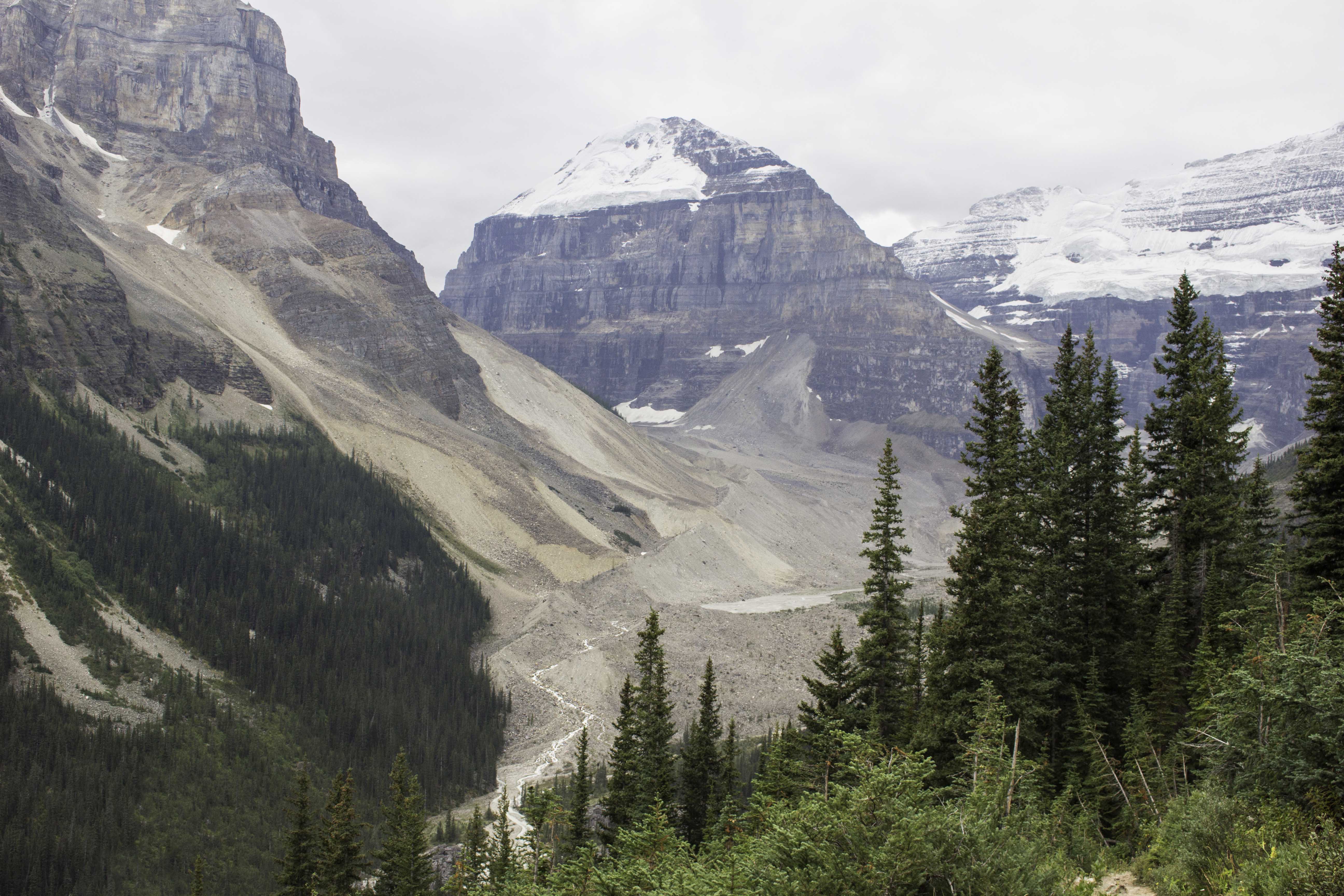
Plain of the Six Glaciers, Banff, August 29, 2018, 10.9 miles (17.6Km), + ~2200ft elev
The horses shared some of the trail with the hikers up to the glaciers. IMG_83767_Plain_of_Six_Glaciers_Banff

Plain of the Six Glaciers, Banff, August 29, 2018
We hiked up toward Victoria Glacier and heard a loud crack. The streak of ice down the left side of the photo was from a portion of the glacier that had just fallen. We did not get to see it fall because the sound arrived after the event. All the brown area at the bottom of the photo is also the glacier with “dirt” on top – you can see the ice underneath in the cracks. IMG_83790_Plain_of_Six_Glaciers_Banff

Plain of the Six Glaciers, Banff, August 29, 2018
Oscar, clowning around on the way back down the trail. You can see the Fairmont and Lake Lousie in the distance. From here we detoured up the left side of the valley to visit Lake Agnes to have tea and scones at the Tea House. IMG_83809_Plain_of_Six_Glaciers_Banff

Plain of the Six Glaciers, Banff, August 29, 2018
More horse riders coming up the trail. IMG_83810_Plain_of_Six_Glaciers_Banff

Plain of the Six Glaciers, Banff, August 29, 2018
The trail back toward the glacier. IMG_83815_Plain_of_Six_Glaciers_Banff
Plain of the Six Glaciers, Banff, August 29, 2018
Crossed a meadow with Fireweed on our way to Lake Agnes. IMG_83821_Plain_of_Six_Glaciers_Banff
Plain of the Six Glaciers, Banff, August 29, 2018
IMG_83833_Plain_of_Six_Glaciers_Banff

Takakkaw Falls, Yoho National Park, August 30, 2018
We climbed up from the valley floor below to reach the Iceland trail to visit more glaciers. This trail was our first in Yoho National Park and provided a great view of the 1250 ft Takakkaw Falls across the valley. IMG_83878_TakakkawFalls_Yoho

Iceland Trail, Yoho National Park, August 30, 2018
Clouds above and below with the sun rays caught our attention as we headed up the side of the valley. IMG_83886_Iceland_Yoho

Iceland Trail, Yoho National Park, August 30, 2018
Here we are above the treeline approaching the glacier. IMG_83918_Iceland_Yoho
Iceland Trail, Yoho National Park, August 30, 2018
The retreating glacier has left mounds of rubble (moraines) that offer great views from the top. The narrow footpath up this one made you feel like you were walking up a ridge. IMG_83930_Iceland_Yoho
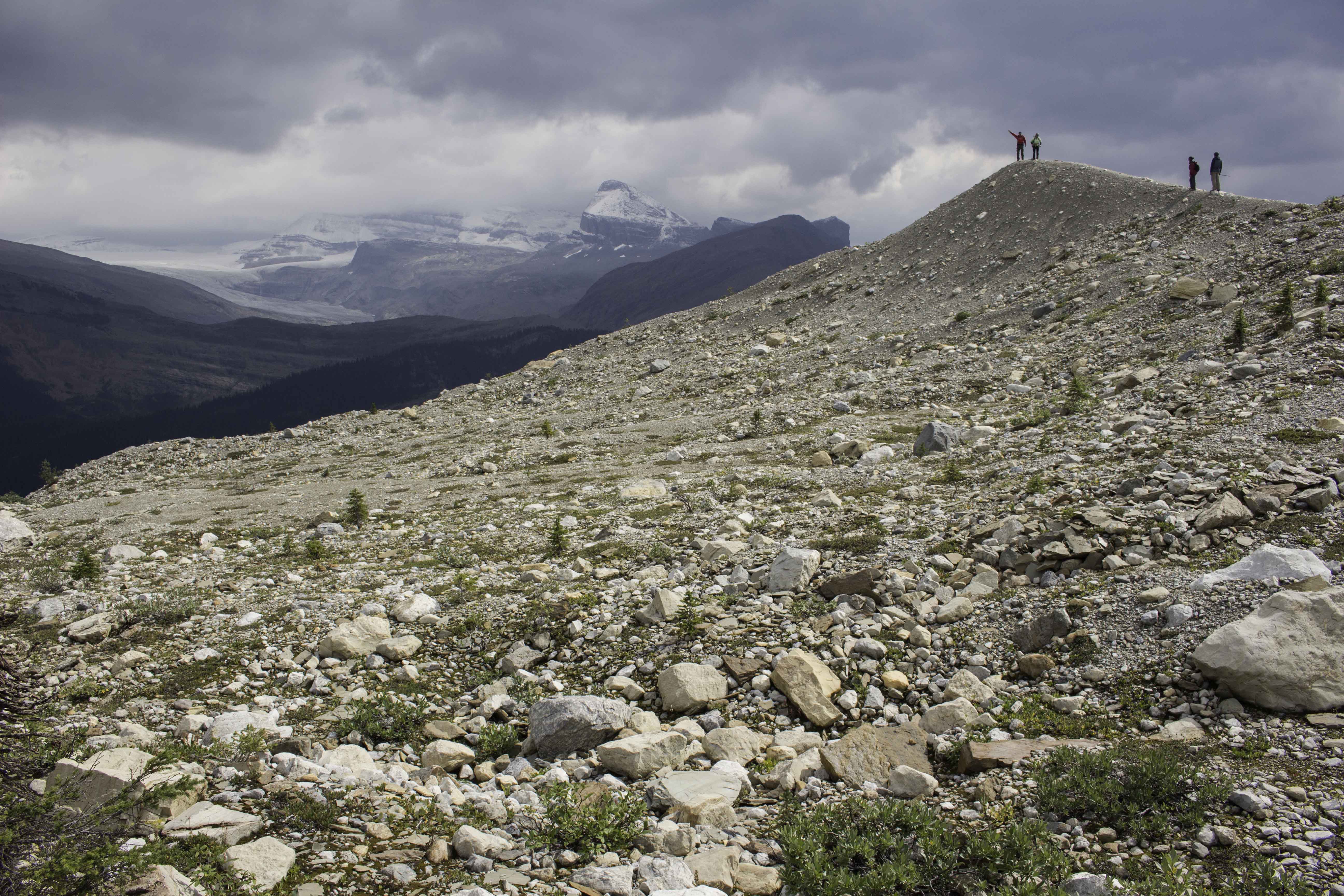
Iceland Trail, Yoho National Park, August 30, 2018
Our guide, Michelle, was explaining the geology and history of the area. IMG_83951_Iceland_Yoho

Iceland Trail, Yoho National Park, August 30, 2018
There were several small lakes from the glacier ice melt. This one had a small waterfall filling it. IMG_83971_Iceland_Yoho

Iceland Trail, Yoho National Park, August 30, 2018
Heading back down into the valley as a small amount of snow, then rain, fell. This was our last hike with the White Mountain group. IMG_83975_Iceland_Yoho

Emerald Lake and Basin Trail, Yoho National Park, August 31, 2018 6.8miles, + 1400 elevation
Emerald Lake is a popular area and has a nice lodge (you can see across the lake). We were hiking along the lake shore to catch a trail up to a basin above the lake. IMG_84009_Emerald_Lk_Yoho

Emerald Lake and Basin Trail, Yoho National Park, August 31, 2018
Oscar is making his way up the rocky surface toward the twin waterfalls at the end of the basin. When we started this trail, hikers coming down told us the basin was totally in the clouds and they could not see anything. We were lucky that the low clouds had dissipated and only the high clouds remained. IMG_84047_Emerald_Lk_Basin_Yoho

Emerald Lake, Yoho National Park, August 31, 2018
After returning from the basin, we walked around the other side of the lake to complete the circle. The wind was more calm so I could get a good reflection in the lake. IMG_84076_Emerald_Lk_Yoho

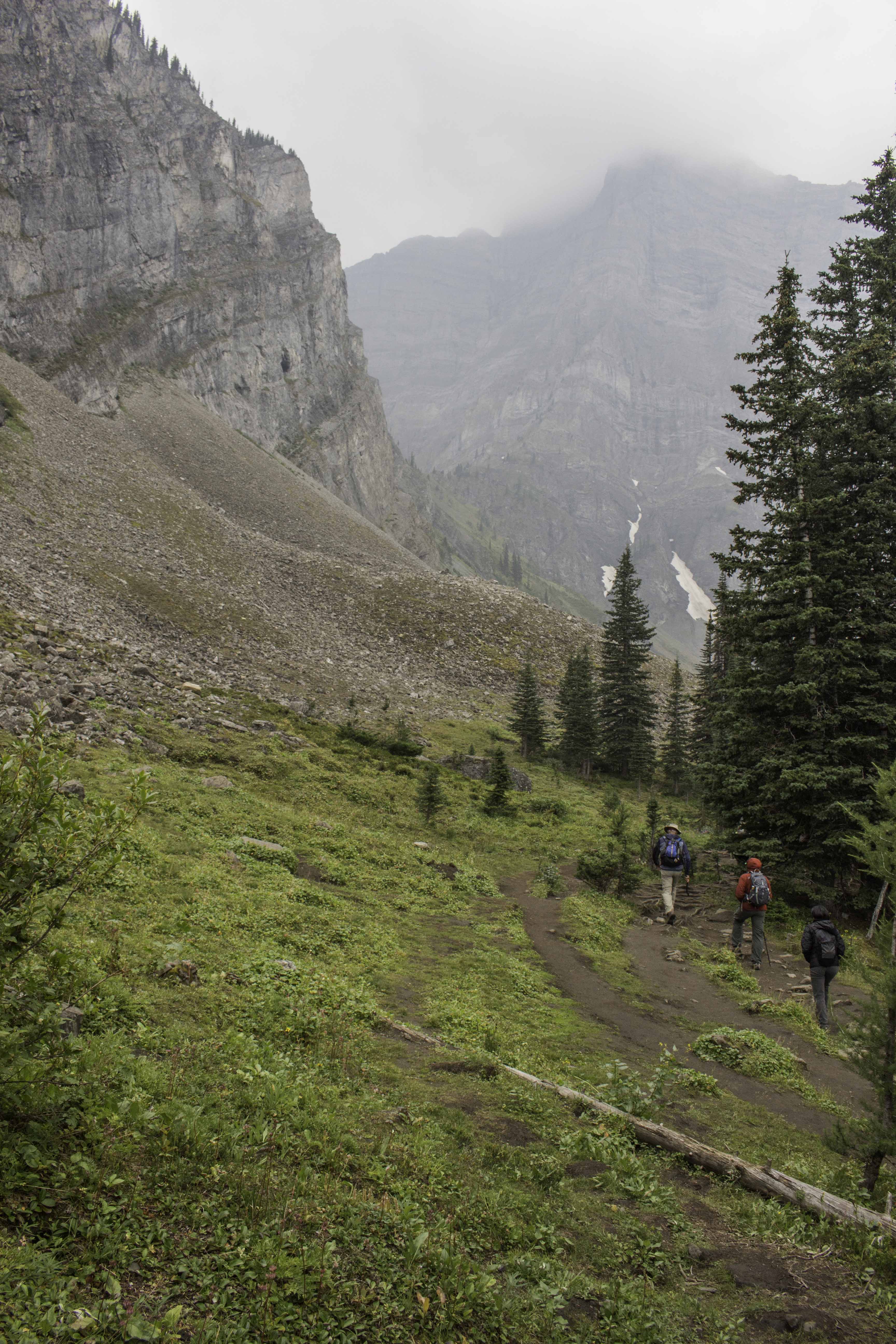
Wilcox Pass Trail, Jasper National Park, September 1, 2018 5.7miles (9.2 Km), + 1342elev
Since it was so smoky at the beginning of our trip in Canada, we skipped this trail because there would not have been good vistas. Near the end of our trip, we drove the 2 hours from Banff to do the trail and were rewarded with another overnight snow. The trail climbs from the valley to a pass. A nearby mountain was named Mt Wilcox in honor of Walter D Wilcox, an explorer of the Canadian Rockies in the 1890’s. The pass near the mountain was named after Wilcox also. This trail is one of the highest rated trails in Jasper Nat Park because of the great views of the Athabasca Ice fields (the glacier is the white patch on the right side of the photo). IMG_84171_WilcoxPass_Jasper

Wilcox Pass Trail, Jasper National Park, September 1, 2018
Bighorn Sheep along the trail. IMG_84147_WilcoxPass_Jasper
Wilcox Pass Trail, Jasper National Park, September 1, 2018
Near the pass and the lookout, there was a lot of snow on the ground. IMG_84171_WilcoxPass_Jasper

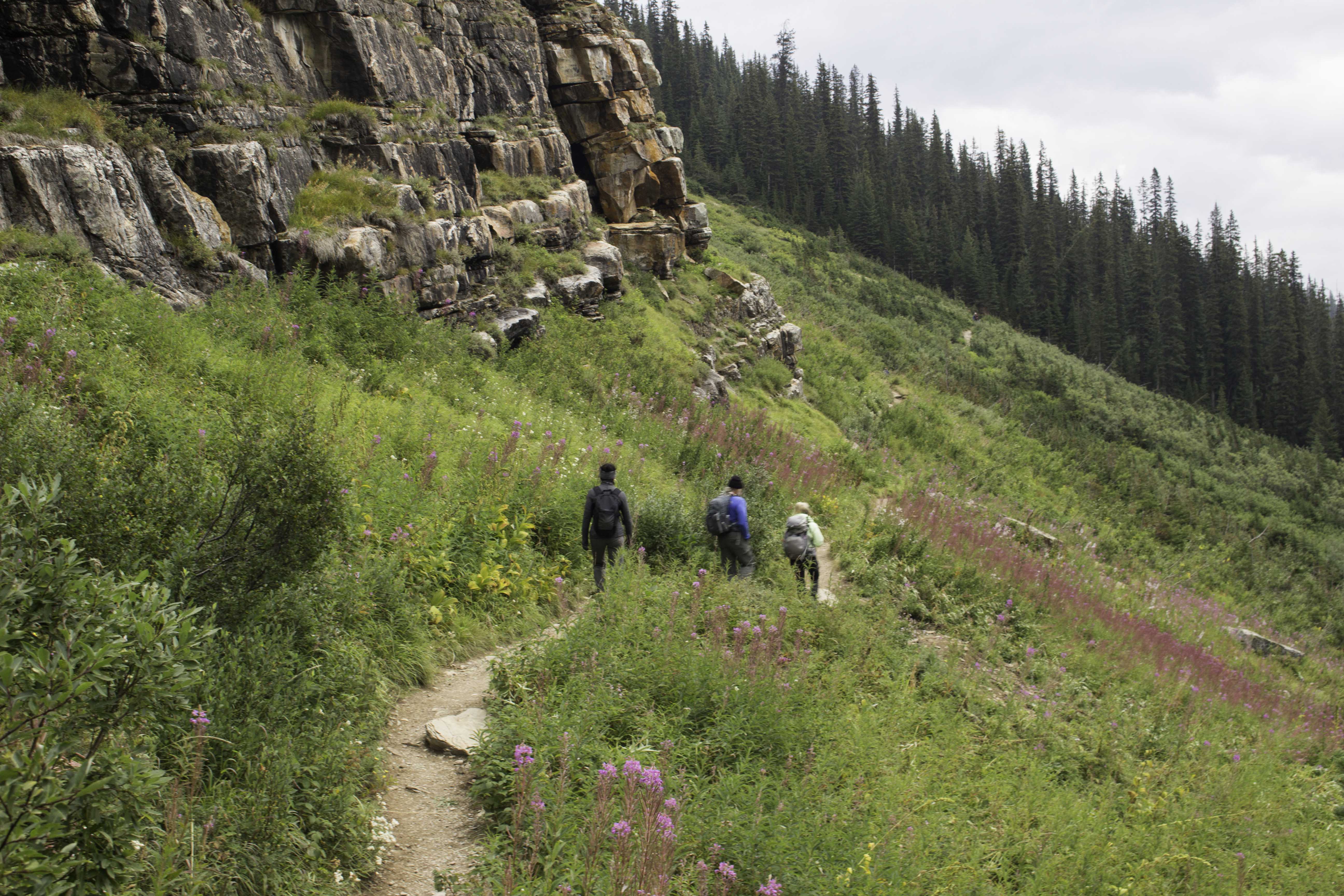
Boundary Lake Trail, Banff National Park, September 1, 2018, 2.5 miles (4Km), + 656ft elev
Michelle, our guide from the previous tour, told us about this quiet trail out to a lake fed by the Boundary Glacier. IMG_84221_BoundaryLk_Banff

Peyto Lake, Banff National Park, September 2, 2018
This beautiful glacier lake is very popular – even has bus loads of people visiting the crowded viewing platform. But if you go up the trail a bit farther, you get to this quiet rocky area. IMG_84283_Peyto_Lk_Banff

Last Day in Banff, September 2, 2018
Because it was raining and we had not toured the town of Banff, we got lazy, slept in, and then did the tourist thing for our last day in the Rockies. Here we are sampling the offerings of a micro brewery and having lunch. It was a great trip and we agreed it was well worth coming back someday. IMG_84463_Banff


Fantastic photos!